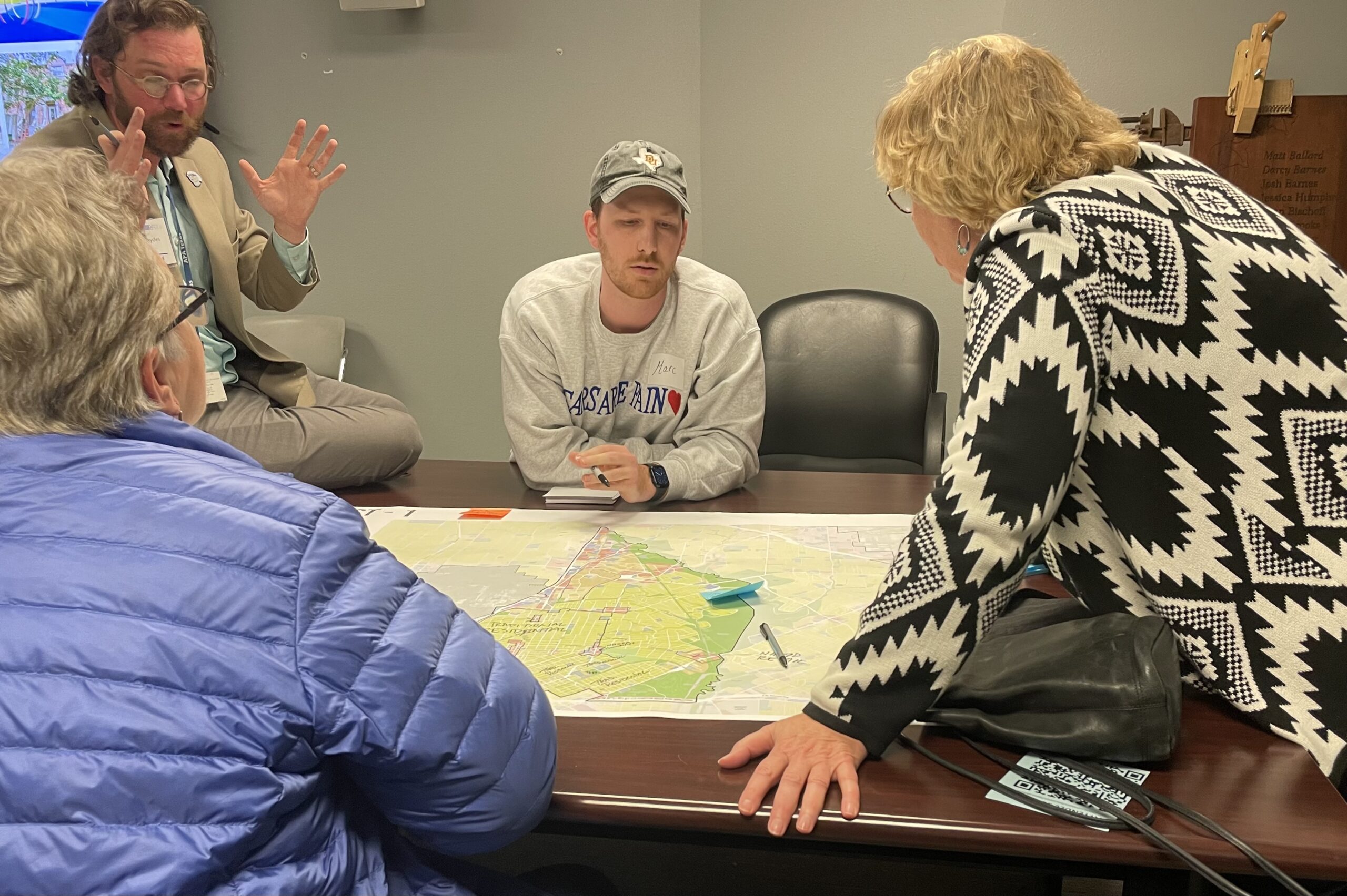
Stakeholders at a March 20 Forward Dallas meeting at Boys & Girls Club in East Dallas. Photo by Renee Umsted.
Stakeholders in East Dallas said they wanted to maintain residential neighborhoods at a land use meeting hosted by the City of Dallas.
The city is gathering public input on Forward Dallas, an update to the 2006 vision plan.
“It’s about being intentional, making decisions about what we want certain areas of Dallas to look like and to feel like and then being proactive about the policies to get those places, either keep them as they are or to maturate them to that type of place that we want to be,” senior planner Patrick Blaydes said.
Forward Dallas will work with the city’s climate, mobility, racial equity and housing plans, among others, but it is separate.
It is not the same as zoning, either. A land use plan provides a guide to what types of things are allowed in an area, but zoning is much more specific, Blaydes said. Land use would say an area should be more commercial, with retail and restaurants. Zoning would say a site should be a restaurant with seven parking spaces.
A couple of meeting attendees were concerned about Baylor University Medical Center. There seemed to be some confusion caused by the colors used in a placetype map available online, where people can leave comments. An area roughly bounded by Live Oak Street, Peak Street, Main Street and the DART rail line — encompassing more property than Baylor’s existing campus — was labeled institutional campus/special purpose.
By delineating placetypes, visions that combine land uses and design to create a specific feel to a place, Dallas residents can shape how areas look and feel. For example, being on Baylor’s campus feels and looks a certain way; if Baylor were to expand into a different placetype area, it would have to match that placetype.
Other areas where neighbors are concerned about “encroachment,” as one meeting attendee put it, include commercial uses moving into residential areas along Greenville Avenue and Henderson Avenue.
Placetypes are defined by certain elements — type and amount of residential structures, schools, type and size of businesses, churches, parks — combined in different quantities.
White Rock Lake Park and Tietze Park are both East Dallas parks, but they have obvious differences.
A blended/mixed residential neighborhood is predominantly single-family homes, but there are some townhomes, small apartments or duplexes, as well as some commercial uses in certain places. An urban residential neighborhood, on the other hand, is majority townhomes and apartments, with some duplexes or single-family homes, along with more commercial uses in more places.
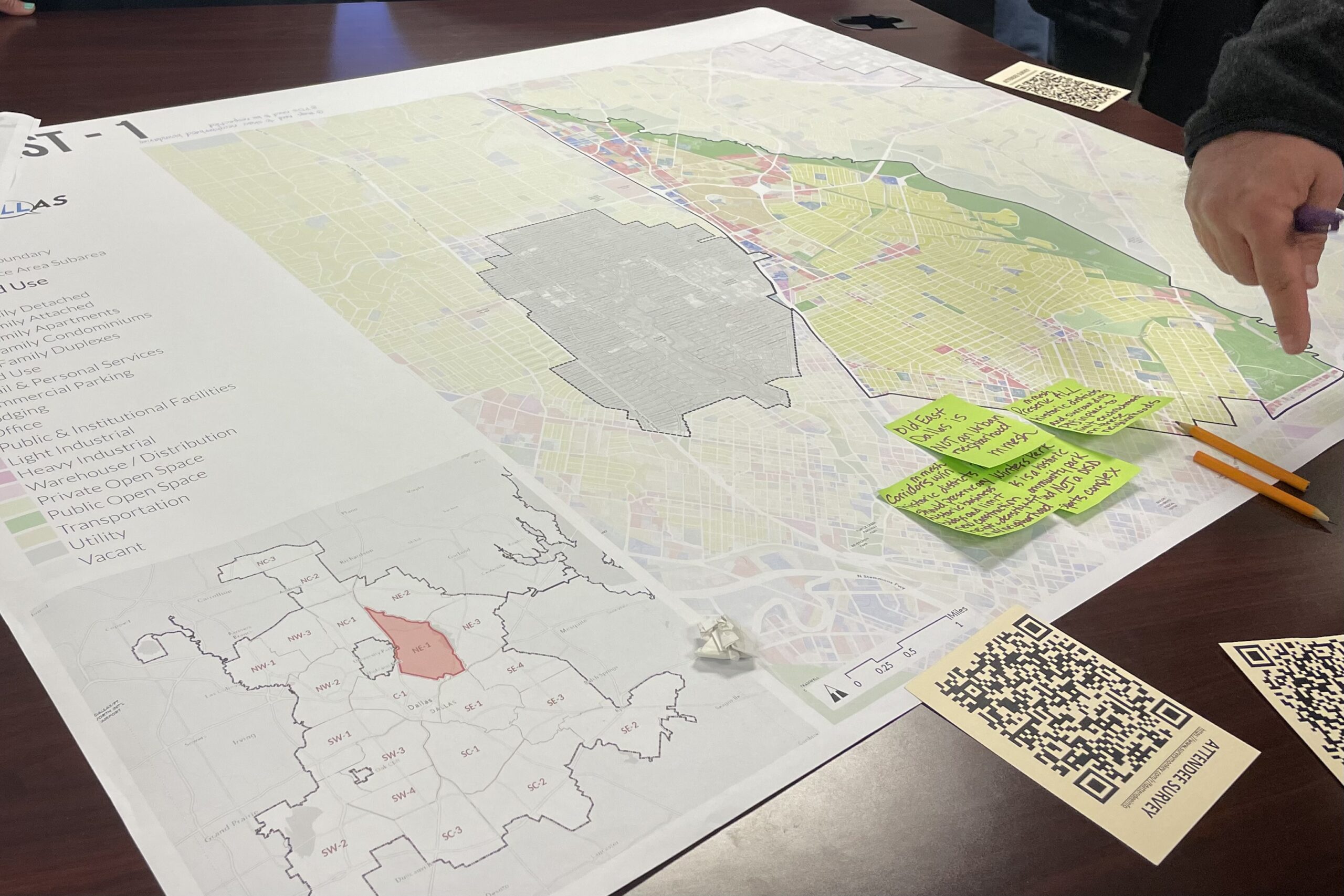
Map at Forward Dallas meeting on March 20. Photography by Renee Umsted.
While a future land use plan can convey an overview of a place, area plans would be needed to provide specificity, Blaydes said.
Meeting attendees wrote notes on maps with their feedback about how parts of East Dallas should look. Many of the comments included protecting historical neighborhoods and parks and allowing walkable, commercial uses in certain areas.
They also asked for additional meetings and new maps to consider specific neighborhoods. Blaydes said they had already met with representatives of the Junius Heights Historic District.
“This is a completely transparent process,” Blaydes said. “And none of these decisions are meant to be behind closed doors. It’s all open.”