Photo by Hilary Schleier
Dallas’ Citywide plan, Forward Dallas 2.0, goes to the Council for approval tomorrow, Sept. 25. Councilmember Paul Ridley (District 14) presented amendments to the ForwardDallas plan during the Economic Development Committee meeting on Sept. 3. The amendments, which have since been approved, addressed the desire to protect single-family neighborhoods, while increasing housing options. In total, there were about 34 section revisions made, 26 of which were made by Councilman Ridley.
This 2.0 version of the ForwardDallas plan has about 63 pages of content. Let’s unpack the terminology, key points and information provided in the plan.
Terminology
ForwardDallas: the Citywide land use plan establishing guidelines for public and private lands should be used and what the city should look like as a result.
Zoning: the division of the City into districts and prescribing regulations for each district.
Placetypes: a description of the desired building and preservation characteristics for different places in the city.
Regional Open Space (RO): open spaces that are typically open to everyone and can be programmed with recreational and leisure activities. Examples include lakes, rivers, streams etc.
Small Town Residential (ST): a mix of small single family neighborhoods and rural estate lots with active agricultural uses. They are representative of some of the last areas to be annexed to the City in the 1960s and 1970s, which had their own identity prior to annexation.
Community Residential (CR): makes up the largest percentage of land within the City and is primarily made up of single-family homes. Has parks, schools and places of worship interspersed throughout. Lakewood is listed as a local example of this type.
City Residential (CU): primarily consist of high and mid-rise multifamily development, complemented by townhomes and duplex housing. Has the most variety of housing types among the residential placetypes.
Neighborhood Mixed-Use (NM): incorporates local-serving retail, services and dining options. A mix of low and medium-density residential.
Community Mixed Use (CM): areas located at major intersections and along key corridors. They serve multiple surrounding neighborhoods and attract retailers and services that require a larger market area.
Regional Mixed-Use (RM): accommodates a wide range of large retail, commercial, office and institutional uses connected by the City’s major roadways.
City Center (CC): a complete and connected neighborhood made up of the centrally located Downtown District and its adjoining communities.
Institutional Campus (IC): a conglomerate of multiple areas throughout Dallas where large master-planned educational, institutional and business facilities primarily exist.
Flex Commercial (FC): a mixture of general commercial employment centers and smaller scaled, light industrial uses. Should be designed to be versatile and accommodate a mix of uses at once.
Logistics/Industrial Park (LP): identified for wholesale, large distribution areas and storage uses focused on production and employment.
Industrial Hub (IH): areas identified for heavy industrial production, salvage and storage operations.
Acronyms
Historic Districts (HDs)
Neighborhood Stabilization Overlays (NSOs)
Conservation Districts (CDs)
Planned Developments (PDs)
Transit-Oriented Development (TOD)
Key points and important information
The first ForwardDallas plan was adopted in 2006. The current plan acknowledges that since the 2006 plan, residents have been displaced. This has led to the two primary topics for 2.0 the plan being (1) the housing needs of Dallas residents being met — while facing a housing shortage and a projected increase in housing demand — and (2) ensuring that residents in established neighborhoods are not displaced.
The execution of the plan will be and has been done primarily through zoning. Zoning can be initiated by property owners or by the City. It also can happen through the City’s Capital Improvements Program that allocates funding for City projects such as parks, streets and utility connections.
ForwardDallas 2.0 does not constitute zoning or change zoning. It does not establish zoning district boundaries or regulations. It does not guarantee that individual properties are suitable for the full range of land uses and design characteristics outlined in each placetype. It informs the decisions made about both zoning and development.
ForwardDallas 2.0 doesn’t prevent or change CDs, HDs, NSOs or other neighborhood-led Planned Developments that are currently underway or that may be created in the future.
The 2.0 plan has five themes that are made up of a primary goal that provides an outline of objectives and recommendations on how to achieve each theme goal. Each theme in the plan notes that key performance indicators will be developed and tracked after the plan is adopted through annual reporting to either the City Plan Commission or the Council. Find the metric/measurement of success for each theme listed below.
Environmental Justice and Sustainability – Decrease the percentage of industrial zones/uses near residential zones/uses.
Transit-Oriented Development and Connectivity – Increase the percentage of land use mix within TOD Centers
Housing Choice and Access – Increase the number of housing units in areas of displacement risk, TOD areas and commercial corridors.
Economic Development and Revitalization – Increase the percentage of mixed-use zoning along commercial corridors.
Community and Urban Design – Metrics for this theme are going to be developed with citywide urban design guidelines.
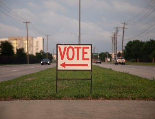
Learn more about how to register to speak at the public hearing happening tomorrow, Sept. 25, here.
This article has been edited for accuracy.