The Dallas Redistricting Commission tweaked two maps at its May 2 meeting and is ready to hear the public’s feedback.
Maps 17 and 41 were the plans the commissioners agreed to move forward with.
Commissioner Domingo Garcia modified map 17 and came up with this new version. Commissioner Norma Minnis amended map 41 and came up with this new version. These were both adopted by the full commission after discussion.
Residents are invited to share input on the revised maps May 7 at 3:30 p.m. Register to speak at the public hearing here by 10 a.m. tomorrow.
Commissioners are expected to select their final map May 9 and submit their final proposal to the mayor May 16.
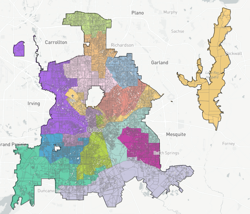
Revised map 17.
Here are some of the key changes in the new map 17 in relation to District 9 and District 14:
- District 14 was extended across Central Expressway to include an area roughly bordered by Bennett Avenue, N. Haskell Avenue, Ross Avenue and Lafayette Street.
- District 14’s boundaries were modified in Oak Cliff, and it lost a section west of N. Stemmons Freeway.
- District 9 was extended south to include an area north of Knox Street.
- District 9 lost to District 2 an area bounded by Santa Fe Avenue, S. Beacon Street, Victor Street and St. Mary Avenue.
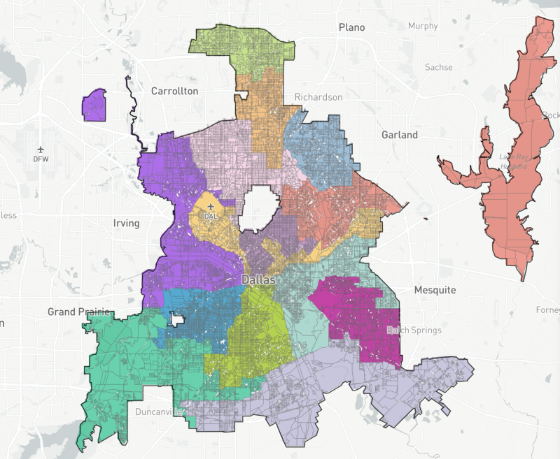
Revised map 41.
Here are some of the key changes in the new map 41 in relation to the East Dallas districts.
- District 9 lost parts of Vickery Meadow.
- District 9 lost to District 14 the area around Mockingbird Station roughly bounded by Greenville Avenue, E. Mockingbird Lane, Dyer Street and Central Expressway.
- District 14 acquired the Lakewood Whole Foods.
- District 9 lost to District 2 an area south of Garland Road near the White Rock Creek.
- District 9 gained from District 2 an area east of Casa View Elementary and the Dallas Athletic Club.
Review the highlights from the original maps here.