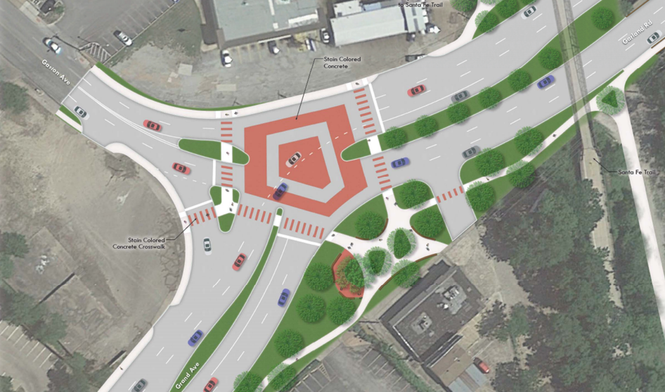
The newly proposed Garland-Grand-Gaston intersection. (Courtesy of TxDOT)
Get used to the phrase “reverse T design” — you’re about to hear it a lot. It’s the preferred choice for how to improve the accident-prone Garland-Grand-Gaston intersection, at least by those who attended meetings last year to consider different options that would improve safety.
The proposed plan makes minimal changes to the existing intersection — all designed to slow down the flow of traffic. Instead of the existing straight shot, which often allows drivers to pick up speed, Garland and Grand, a.k.a. State Highway 78, would be gently arced with new landscaping.
“The geometry will encourage traffic to slow down, which will provide a safer environment compared to current conditions,” says Michelle Raglon, spokeswoman for the Texas Department of Transportation(TxDOT), which is overseeing the project since it includes a state roadway.
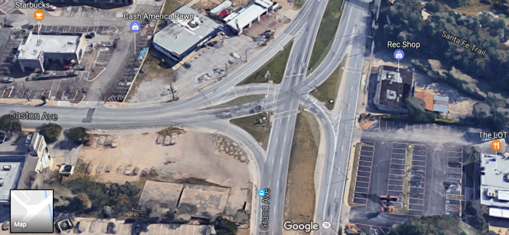
The Garland-Grand-Gaston intersection as it looks today. (Image via Google Maps)
Added bicycle and pedestrian paths would link into the Santa Fe Trail at a cost of $1 million, providing more seamless conditions for riding or walking in the neighborhood. The landscaping would be greatly enhanced to create a more park-like setting.
“Landscaping is being added to this project at the request of the public. This is not considered an improvement to safety,” Raglon says.
While neighbors largely preferred the “reverse T” design (the proposed roundabout got just one vote and was quickly nixed from consideration), it may do little to improve the flow of traffic for some drivers,. But mornings will be better than evenings. As the chart below shows, in most directions, the intersection will improve from an “D/F” rating to a “C/D,” although the amount of time cars spend going through the area should decrease.
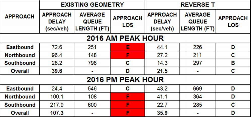
TxDOT’s traffic analysis before and after the intersection overhaul.
Who will pay for it all is a question that has yet to be fully answered. With the trail connector, the total project cost is $5,250,000. It will be split between the city and TxDOT, but who pays for what, and how much, has not been decided. Councilman Philip Kingston, whose district includes the problematic intersection, previously said the city’s portion of funds would be covered by bond dollars.
Raglon says it’s too soon to know other project details, like when construction might begin, how long it would run and how it might negatively impact traffic. “The project is still in the planning stages; this will be analyzed once design is further along,” she says.
While neighbors prefer this design, two more design alternatives will be presented at the next stakeholders meeting, which has not yet been scheduled. As soon as we hear about it, we’ll post the meeting details.